Landseed is built on a simple discipline: language cannot outrun evidence. Today we introduce the twelve-member Scientific Committee that holds us to it — the people whose work defines how ecosystems are measured, mapped, and counted.
A measurement layer is only as credible as the science underneath it. Landseed verifies the ecological condition of land and issues that measurement as an instrument, so the standard we measure against cannot be ours alone to set. Our Scientific Committee brings together remote sensing, field ecology, wildlife statistics, disease ecology, conservation finance, and edge-AI monitoring — the disciplines that, together, decide what an honest measurement of a living system looks like. They are introduced below, in their own right.
The committee
Greg Asner, PhD
Director of Arizona State University's Center for Global Discovery and Conservation Science, where he leads a remote-sensing program mapping land and ocean ecosystems from airborne and satellite platforms at scales no field campaign can reach. A pioneer of high-fidelity airborne imaging spectroscopy and creator of the Allen Coral Atlas, the first global map of shallow-water coral reefs. Author of more than 400 peer-reviewed papers and a senior advisor across NASA, the U.S. State Department, and the United Nations; an elected member of the U.S. National Academy of Sciences. PhD, Geological Sciences, University of Colorado Boulder.
Daphne Carlson, DVM, PhD
Twenty years leading international wildlife conservation at the intersection of federal policy, science, and frontier technology. Most recently Head of the U.S. Fish & Wildlife Service's Division of International Conservation, where she directed more than $100M annually across the Multinational Species Conservation Funds, co-chaired the Presidential Task Force on Wildlife Trafficking, and steered the division to become the first government body in the world designated a Conservation Evidence Champion. Veterinarian (Tufts), wildlife epidemiologist (UC Davis), and AAAS Science & Technology Policy Fellow.
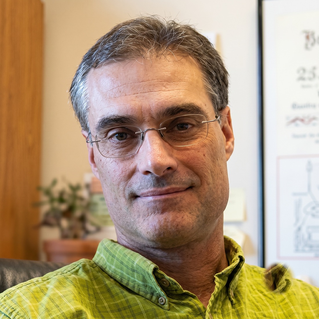
Karl Burkart
Co-author of A Global Deal for Nature (Science Advances, 2019), the paper that introduced 30×30 into the peer-reviewed literature and now anchors the Kunming–Montreal Global Biodiversity Framework. CEO of Nature Data Lab, applying big data, earth observation, and AI to nature recovery, and architect of the Conservation Imperatives mapping that identified 16,825 unprotected priority sites covering 164 million hectares. Previously Director of Science & Technology at the Leonardo DiCaprio Foundation.
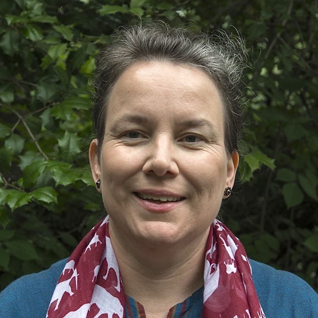
Raina Plowright, PhD
Steffen Professor at Cornell University and Cornell Atkinson Scholar, leading the world's largest transdisciplinary effort to decode the biological mechanisms of viral spillover and translate them into prevention. Co-chair of the Lancet–PPATS Commission on Prevention of Viral Spillover, with field operations on WHO-priority pathogens across Australia, Bangladesh, and Ghana. Author of more than 130 publications and recently elected to the National Academy of Medicine and the AAAS. BVSc, University of Sydney; PhD, UC Davis.
Carlos Peres, PhD
Brazil's foremost tropical ecologist and the most-cited Latin American conservation scientist of all time. Professor of Conservation Biology at the University of East Anglia and scientific director of Instituto Juruá, which co-manages nearly one million hectares of Amazonian sustainable-use reserves alongside 45 ribeirinho communities. His PNAS demonstration that community-governed protected areas deliver biodiversity recovery and measurable human welfare gains earned the 2023 Frontiers Planet Prize. Author of more than 490 peer-reviewed papers; member of the European Academy of Sciences.
Hrishita Negi, PhD
Associate Director of Tigers United at Clemson University, and co-developer of an edge-AI camera system deployed across India's tiger corridors that identifies individual tigers and alerts managers in under 30 seconds, turning post-incident response into pre-attack intervention. Daughter of Indian Forest Service field director Dr. Himmat Singh Negi, she grew up on the buffer of Kanha Tiger Reserve — the lived geography behind her PhD research on human–tiger coexistence in Madhya Pradesh. Featured in the PBS Nature episode "AI of the Tiger."
Eric Wikramanayake, PhD
Landscape ecologist who spent more than two decades as a Senior Conservation Scientist at WWF defining how Asia's great mammals are saved. Co-architect of the Tiger Conservation Units framework, lead designer of Nepal–India's Terai Arc Landscape — the first large-landscape program in Asia, today supporting roughly 880 wild tigers — and co-author of WWF's Terrestrial Ecoregions of the World. Now Senior Rewilding Specialist at NEOM, advising on bankable nature-based solutions for Asian flyways and wetlands. PhD ecology, UC Davis.
Beth Allgood
Founder and President of OneNature Institute and creator of the Wild Happiness Approach, a peer-reviewed methodology placing human and ecological wellbeing at the center of conservation outcomes. Previously U.S. Country Director at the International Fund for Animal Welfare, where she led the policy work behind the Washington, D.C. ivory and rhino-horn ban and the SAVE Right Whales Act. Twenty-five years across IFAW, The Nature Conservancy, WWF, USAID, and the Peace Corps; named to the Explorers Club 50 in 2023.

Anup Joshi, PhD
Conservation scientist at the University of Minnesota, where he coordinates the Conservation Sciences graduate program, and Executive Director of The Carbon Institute. Lead author of Tracking Changes and Preventing Loss in Critical Tiger Habitat (Science Advances, 2016) — the first satellite-based assessment to monitor all 76 Tiger Conservation Landscapes at once — and co-author of A Global Safety Net (Science Advances, 2020). Architect of the GIS modeling behind WWF's Terai Arc Landscape and designer of Nepal's sub-national REDD+ reference framework.

Weiqian Gao, PhD
Quantitative ecologist at the Smithsonian National Zoo and Conservation Biology Institute's Conservation Ecology Center, where she fuses wildlife tracking, camera-trap monitoring, remote sensing, and geospatial analytics into the biodiversity indicators and decision-support tools managers use in the field. Her published work spans population viability analysis, statistical model selection in applied ecology, and spatial landscape analysis across the Americas, Africa, and Asia. PhD, Ecology and Conservation Biology.
Bob Crabtree, PhD
Founder, President, and Chief Scientist of the Yellowstone Ecological Research Center, the independent nonprofit he established in 1993, now spanning more than 120 projects and 200 peer-reviewed publications. His long-term canid program positioned YERC to monitor the 1995 wolf reintroduction in real time, producing foundational work on predator–prey dynamics and trophic cascades. A pioneer of MODIS–Landsat fusion for ecosystem-scale productivity monitoring and architect of YERC's WildNET, LandNET, and RiverNET observatory networks.
Samantha Strindberg, PhD
Wildlife statistician at the Wildlife Conservation Society since 2001, designing the global monitoring programs and survey techniques behind how the world counts wild populations. Her analyses feed the IUCN Red List, range-wide species action plans, and decisions at CITES Conferences of the Parties, and her training courses have built the statistical capacity of a generation of field scientists. Author of definitive book chapters on distance sampling and more than 70 peer-reviewed papers. PhD Statistics, University of St Andrews.
Why this matters
These twelve scientists do not endorse a product; they hold a standard. Their disciplines — the mapping of ecosystems from the air, the counting of populations on the ground, the statistics that turn observation into evidence, the field economics of community-led conservation — are precisely the ones a measurement layer must satisfy to be trusted. Their involvement is a commitment that what Landseed measures, and how, will answer to the science rather than to the market.